How it works
From the street to the dashboard, in one continuous flow.
Mapzer turns what happens on the roads into information ready for decisions. See how, from start to finish.
Step by step
Three stages, from the asphalt to the dashboard.
Capture in motion
Vehicles with cameras and sensors travel the roads and record the territory, without interrupting traffic.
AI detects and classifies
The artificial intelligence recognizes and georeferences dozens of types of occurrence automatically, with visual proof.
Dashboard and action
Everything arrives organized in a dashboard: prioritized by risk, filterable by area and ready for the team to act.
Features
Built for those who decide, day after day.
Six ways to bring the operation out of the dark and put the territory on the map.
Everything in real time
A living map with every occurrence across the territory, updated all the time. Your team stops finding out about problems from a ringing phone.
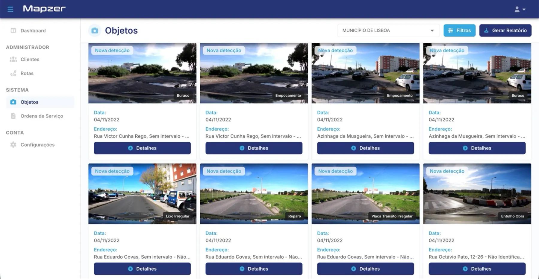
Visual proof of every point
Each occurrence comes with a photo and exact location. It becomes easy to understand the problem before sending anyone out there.
Reports that tell the story
Data by type of occurrence, period and region, ready to present in a meeting, in the budget or in accountability reporting.
Each team in its place
The platform is segmented: each team sees only what falls under its responsibility, with no noise.
Priorities by risk
The intelligence ranks occurrences by severity, so your team starts with what really matters.
Complete memory
The entire history of interventions is recorded. You can prove what was done, when and where.
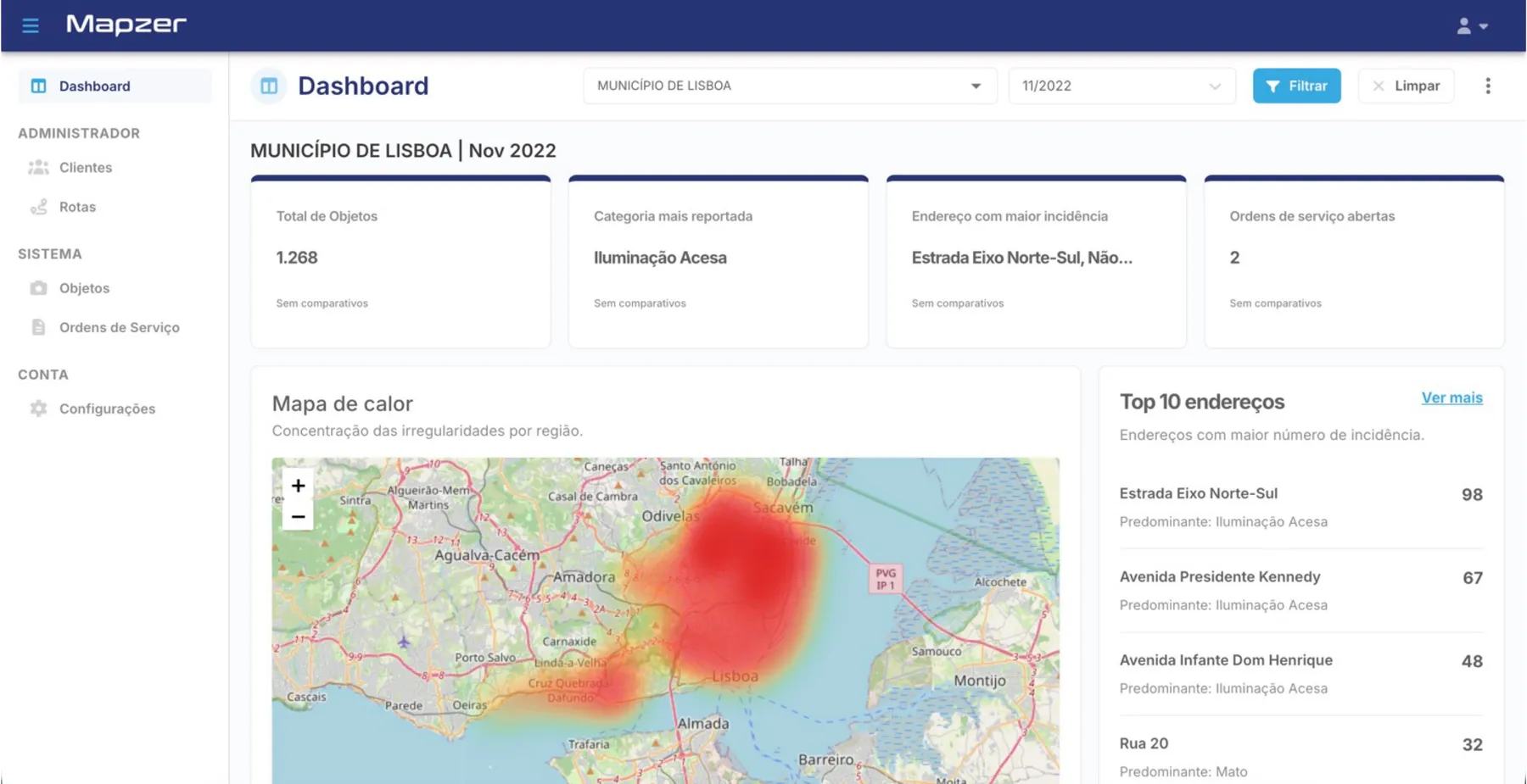
Command view
You see the entire territory at once.
Instead of loose spreadsheets and systems that do not talk to each other, a single place to see, prioritize and follow up.
- Heat map by type and severity
- Filters by region and period
- Automatic alerts for what is urgent
- Export ready to present
Want to see the platform from the inside?
Set up a conversation. We will show you the platform with real data from your operation.